

From the US National Weather Service
A fast moving cold front will bring rain and snow to the area tonight.
The timing would see the snow begin in the northwest corner of our forecast area around 8pm, reaching Pittsburgh metro between 10 or 11pm, and then exit to the southeast of the forecast area around 7 or 8am on Tuesday.
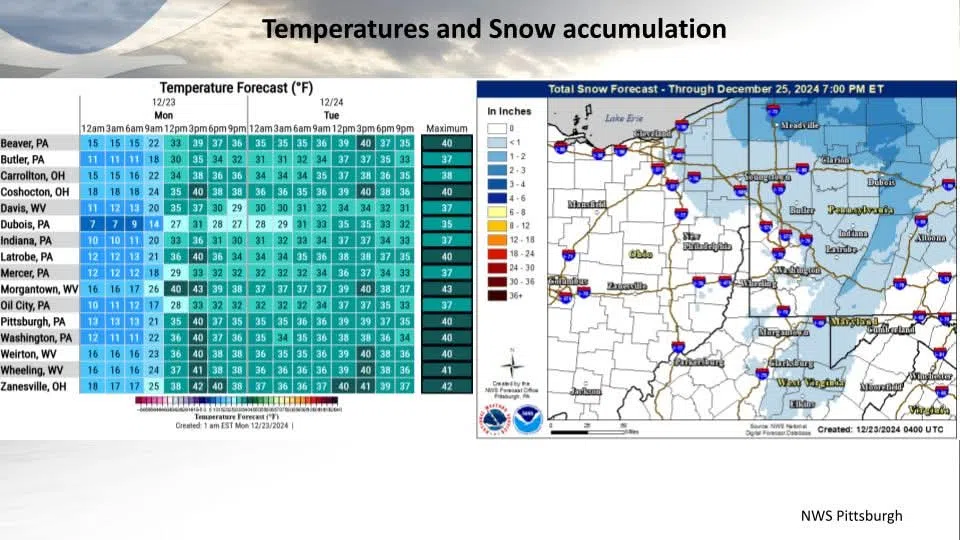
There is a lack of cold air with this system, which is making the precipitation type forecast difficult. Locations in the I-80 corridor look to remain all snow as temperatures there should be just cold enough. Locations to the south of I-80 may begin as rain and then transition to snow as the precipitation cools the atmosphere.
The other concern is the risk for freezing rain/freezing drizzle on the backside of the front over the ridges on Tuesday. This threat exists because the precipitation may turn back to rain behind the front and surface temperatures in the ridges will stay below freezing.
The accumulation forecast is tricky as well because temperatures south of I-80 and west of the ridges may remain above 32 degrees through the entire event which will limit snow accumulation.
There is the risk for increased snow rates (>0.5″ per hour) when the front moves through. This could cause a rapid reduction in visibilities and also a quick coating of snow on area roadways.
Be prepared for rapidly deteriorating conditions if you will be traveling tonight.