

From the US National Weather Service
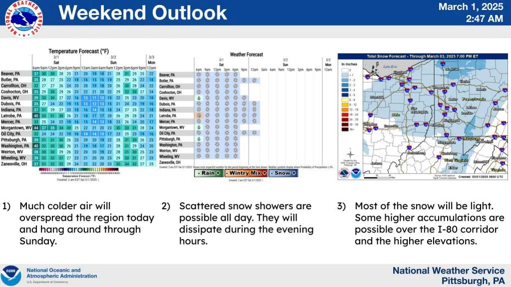
A pre dawn cold front has passed to the east of the area. This front will drag arctic air southeastward today.
Winds will become northwesterly this morning and these winds, combining with the cold air, will promote the development of scattered snow showers. Snow showers are expected through much of the day as temperatures continue to fall. For the most part, accumulations will be light. Higher accumulations are possible over the usual places. The I-80 corridor and the ridges. Snow showers will dissipate this evening and skies will clear overnight. This will allow for a very chilly start to Sunday. Sunday will be dry, but high temperatures will be well below normal.