

From the US National Weather Service
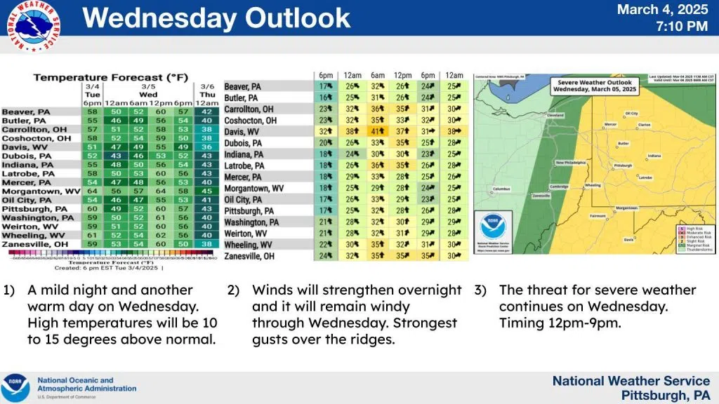
The weather is going to get more active on Wednesday. A mild night ahead with overnight lows well above normal. Rain will begin to overspread the area late tonight as a warm front approaches from the southwest. The rain may take some time to reach the ground as a very dry atmosphere is in place.
Currently there is almost a 50 degree spread between the surface temperature and surface dewpoint over parts of the area. That is dry. Once the rain gets started it should continue through at least the morning hours, before a break is possible. Another boundary will move through late in the day which would be the focus for any severe storms.
Finally, a strong cold front will barrel through tomorrow evening, bringing much colder temperatures and scattered snow showers Wednesday night. So for timing everything. Stronger wind gusts will begin sometime after 4am first over Ohio and then spread eastward as dawn approaches. Rain will do the same, likely arriving a little bit earlier. The threat for severe weather will increase during the afternoon and continue into the evening. It looks like there is a window of 4 to 5 hours beginning late in the afternoon where the ingredients needed for severe weather will be optimized.
Stay tuned for updates on this threat.