


From the US National Weather Service
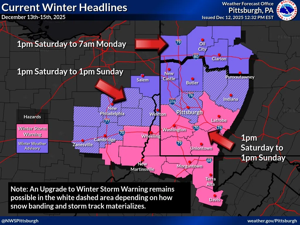
The winter storm watch has been upgraded to a warning with the highest confidence (60% to 80%) chance of seeing >6″ of snow. But there is slightly more uncertainty in the forecast decision just north of that area depending on the extract low track and areas where the heaviest banding is expected.
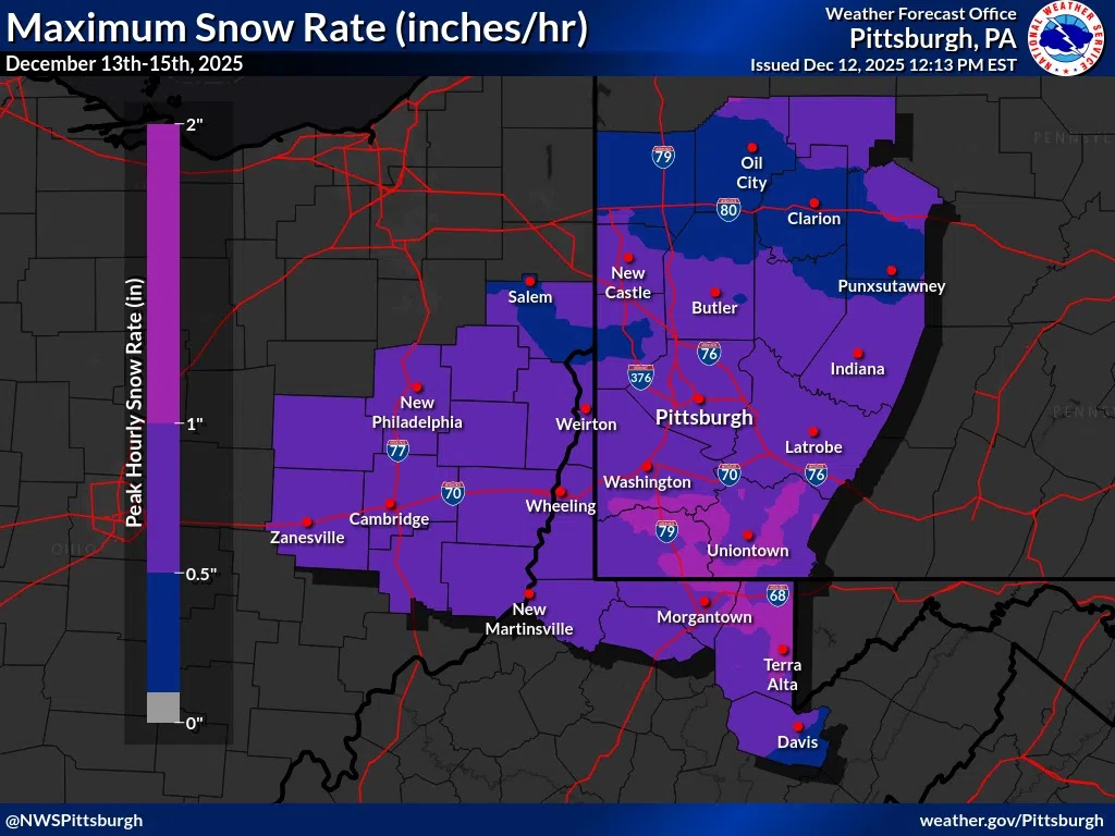
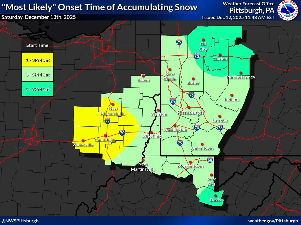
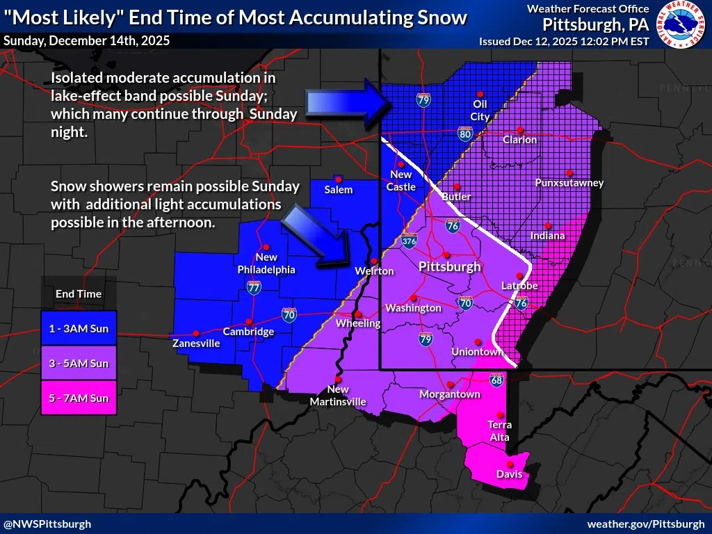
As shown in the onset/end time graphics, the bulk of accumulating snow is expected to overspread the area between 1pm and 7pm on Saturday, departing from 1am to 7am Sunday. Most of the area is expected to see 0.5″/hr to 1″/hr rates at times, highest south of I-70 in WV/PA. The highest snowfall rates are expected to arrive between 5pm and 7pm, and depart from 11pm to 2am.
Lake-effect snow could fill in in it’s wake through Sunday night. Most areas will see minimal to no additional accumulations in lake-effect, through the highest chance of additional accumulations would be in the I-80 corridor and northeast of Pittsburgh in a Huron-Erie lake band. Very localized additional totals of 4″-6″ are possible should this materialize. We will keep a close eye on this into the day Sunday for additional impacts or hazards, if needed.