

From the US National Weather Service
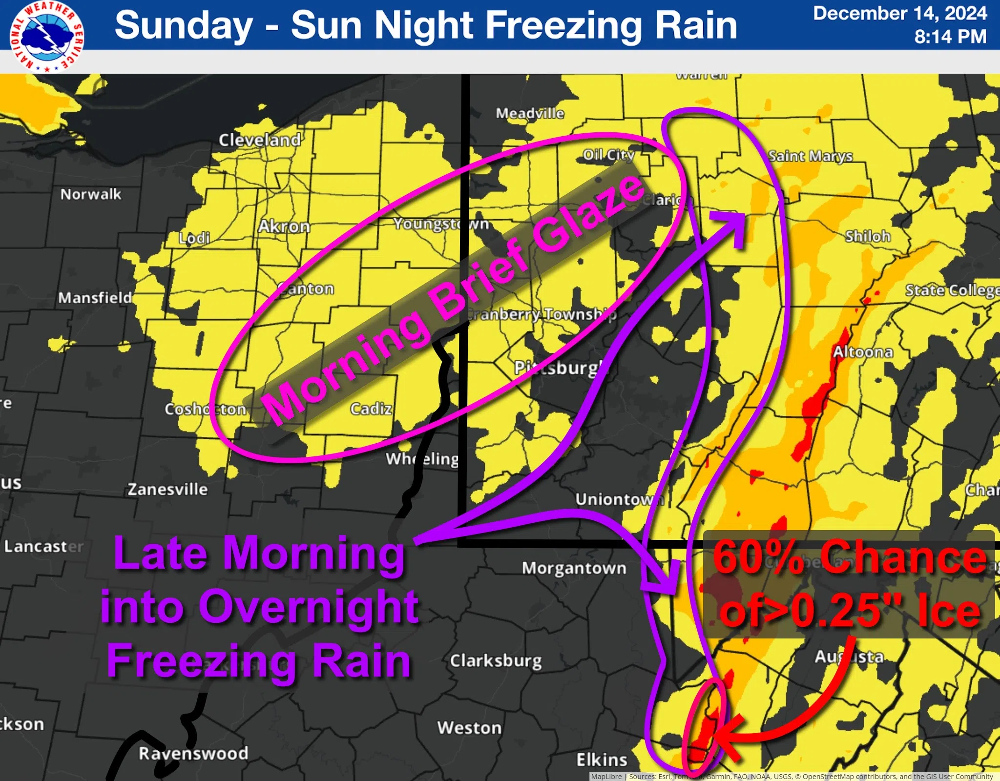
This graphic summarizes the National Weather Service’s expectations for freezing rain (ice) Sunday and Sunday night.
For portions of eastern Ohio into western PA (pink highlight), a brief, light glaze of ice is possible as rain begins Sunday morning. This will be earlier the farther west you are (pre-dawn) and mid to later morning farther east into western PA. Impacts in this area will be brief as temperatures warm through the morning and any freezing rain turns to rain. Slick spots are most likely on bridges and overpasses, which stay cooler than surrounding roads.
More impacts are expected in the ridges into part of the I-80 corridor (purple highlight) because of longer duration and colder temperatures. Freezing rain will start in the morning and linger at least into the afternoon. Higher peaks and cold pockets may see freezing rain into the evening and overnight.