


From the US National Weather Service
We’re still not done with this current snow event, but another one is coming through on Sunday. The worst of it will impact further south, but there is still a chance of significant accumulation in our area.
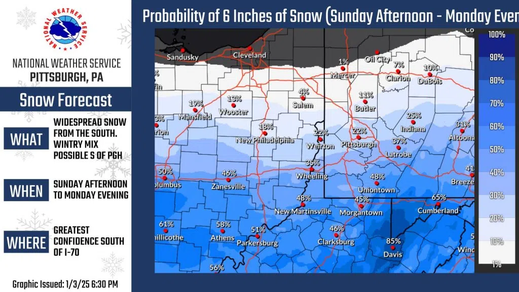
Highest probabilities for 6+ inches of impactful snow remain south of I-70 and especially across the WV ridges.
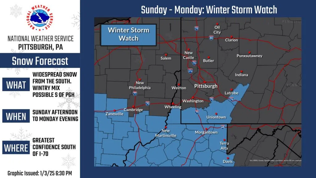
 Winter Storm Watch issued South of I-70 for Sun-Mon…
TONIGHT/SATURDAY: Snow squalls are winding down, but light scattered snow showers will continue through the evening. Showers will taper off Saturday with high pressure.
SUNDAY/MONDAY: Low pressure will cross the area Sunday night into Monday, bringing widespread snow to the region beginning Sunday evening and lingering through Monday.
 Snow totals will be depending on the track of low pressure. We are on the northern side of this system, with higher snow totals expected south of Pittsburgh and a sharp dropoff in snow totals somewhere over our area. Recent model trends have been more southerly, with less snow expected near Pittsburgh.
Confidence in impactful snow is highest south of I-70, where the Winter Storm Watch was issued. If confidence increases in greater snowfall farther north, the Watch will be expanded. (This can also go the other way if the track changes significantly to the south).
A wintry mix is possible briefly Monday morning south of Pittsburgh as low pressure crosses and warmer air mixes in.
Stay tuned for additional updates this weekend.