

From the US National Weather Service
Here is an update regarding the severe risk for Tuesday…
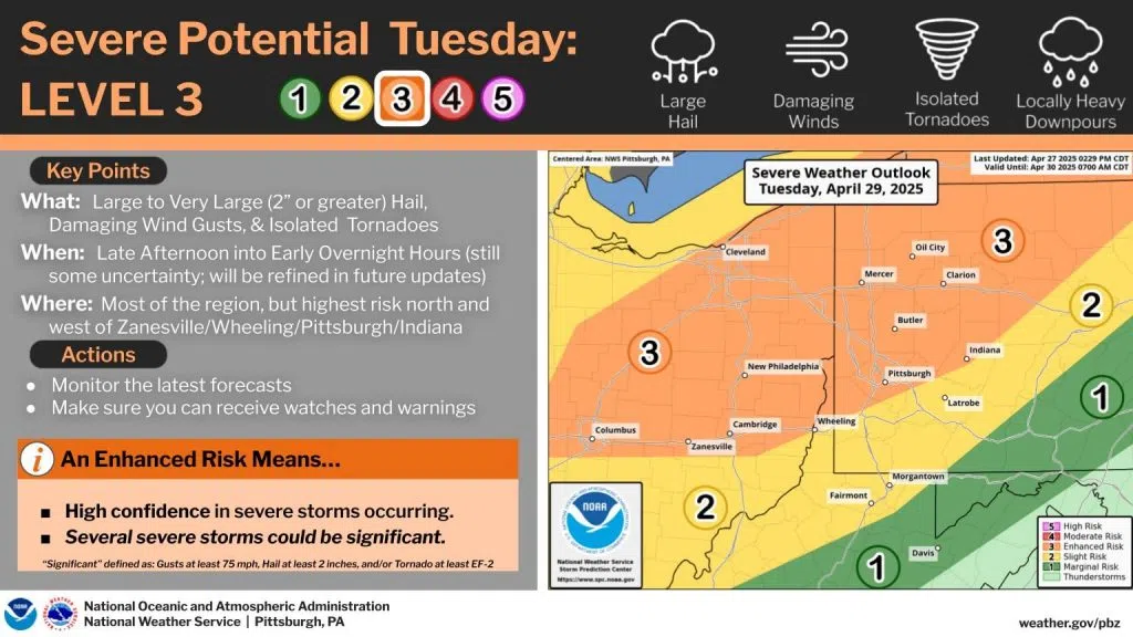
Confidence in severe weather continues to increase as thunderstorms arrive ahead of a cold front on Tuesday. The Storm Prediction Center has upgraded to an Enhanced (level 3 out of 5) Risk north and west of Zanesville/Wheeling/Pittsburgh/Indiana. The threat for large hail was noted in particular – there is potential for 2″ diameter or larger hail in isolated cases in the Enhanced Risk area. Damaging wind and isolated tornadoes remain threats as well.
Timing remains uncertain – impacts are possible from Tuesday afternoon into the early overnight hours. We expect to be able to refine the forecast once more high-resolution models begin to include this period. Stay tuned for updates, and ensure you have multiple ways to receive Watches and Warnings!