


From the US National Weather Service
We’re already getting questions about snow on Friday, so here’s the details:
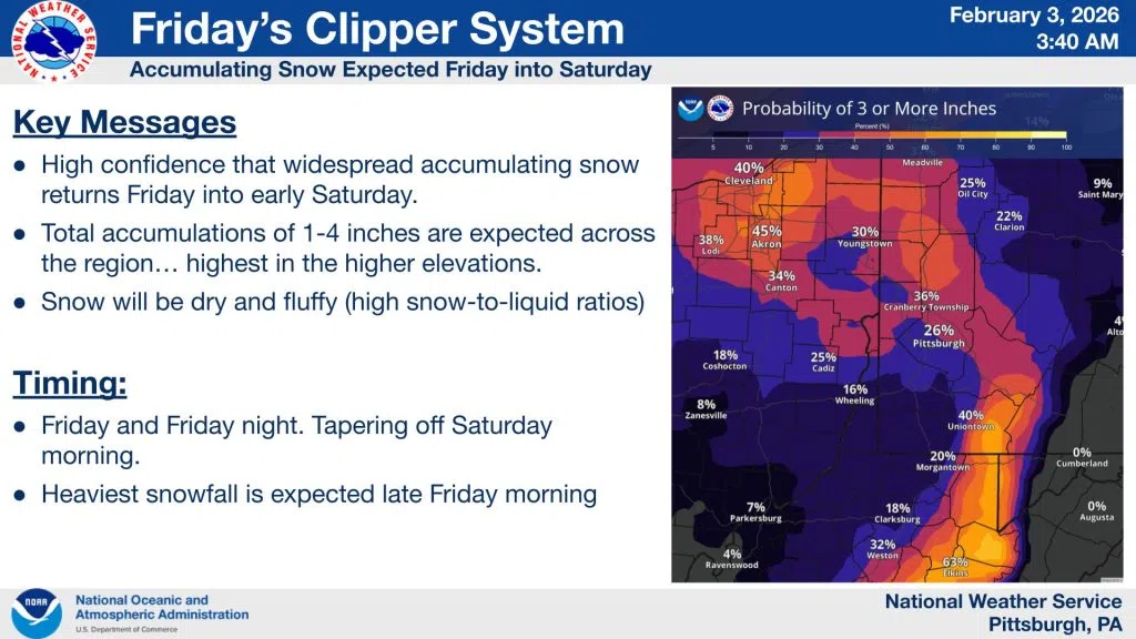
 The Big Picture – A fast-moving “Clipper” is heading our way, bringing widespread snow starting Friday and lasting into early Saturday morning. Confidence is high that we’ll see accumulation across the region.
 Expected Totals – Most spots are looking at 1–4 inches of total accumulation. Locally higher amounts are possible in the higher elevations.
 Snow Quality – Snow will be dry and fluffy (high snow-to-liquid ratios). It’ll be easy to brush off your car and easily blown in the wind.
 Timing –
Heaviest Snow: Heaviest rates are expected late Friday morning.
Duration: Snow continues through Friday night.
Ending: Snow should taper off Saturday morning.